Trnava District (Okres Trnava)
Trnava District (okres Trnava) is a district in the Trnava Region of western Slovakia. In its present borders the district was established in 1996. Before that date Hlohovec district was a part of it. It comprises the villages around the Trnava, which forms an administrative, cultural and economy center of the district. The towns and villages are partly bedroom communities for the people who work in Bratislava, or Trnava.
* Biely Kostol
* Bíňovce
* Bohdanovce nad Trnavou
* Boleráz
* Borová
* Brestovany
* Bučany
* Buková
* Cífer
* Biely Kostol
* Bíňovce
* Bohdanovce nad Trnavou
* Boleráz
* Borová
* Brestovany
* Bučany
* Buková
* Cífer
Map - Trnava District (Okres Trnava)
Map


Country - Slovakia
 |
 |
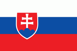
| Flag of Slovakia | |
The Slavs arrived in the territory of present-day Slovakia in the fifth and sixth centuries. In the seventh century, they played a significant role in the creation of Samo's Empire. In the ninth century, they established the Principality of Nitra, which was later conquered by the Principality of Moravia to establish Great Moravia. In the 10th century, after the dissolution of Great Moravia, the territory was integrated into the Principality of Hungary, which then became the Kingdom of Hungary in 1000. In 1241 and 1242, after the Mongol invasion of Europe, much of the territory was destroyed. The area was recovered largely thanks to Béla IV of Hungary, who also settled Germans, leading them to become an important ethnic group in the area, especially in what are today parts of central and eastern Slovakia.
Currency / Language
| ISO | Currency | Symbol | Significant figures |
|---|---|---|---|
| EUR | Euro | € | 2 |
| ISO | Language |
|---|---|
| HU | Hungarian language |
| SK | Slovak language |